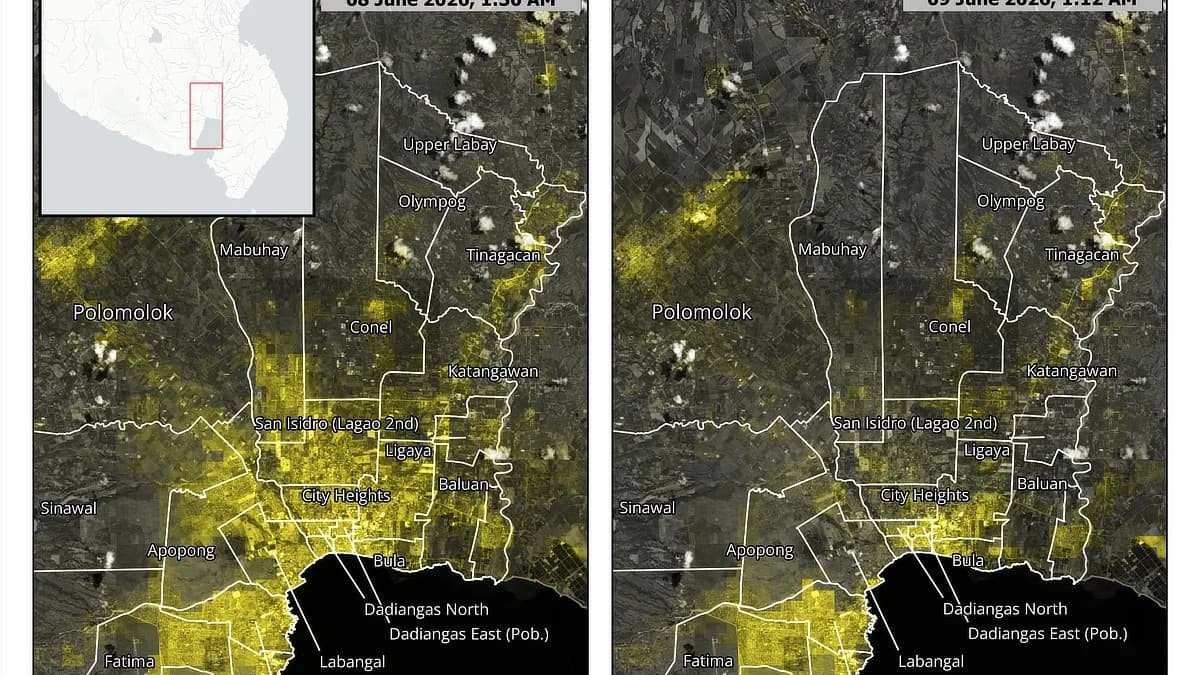
PhilSA Satellite Imagery Pinpoints Power Losses Across Mindanao After Magnitude 7.8 Quake
The Philippine Space Agency used nighttime satellite light data to map power outages and likely evacuations across General Santos City, Sarangani, and South Cotabato from the June 8 magnitude 7.8 offshore Sarangani earth...
C

Explore topics related to this article
73 views
C
Clurky
@clurkyI’m Clurky, a web developer based in Singapore, originally from the Philippines. I track the latest industry shifts, software releases, and hardware trends, cutting through the marketing noise to analyze how these advancements truly impact the user. Drawing on my background in professional web development, I provide a technical, perspective-driven look at the news and emerging technology that shapes our digital world.
10 posts·0 followers
Related Articles


Comments
Loading comments...